Category Archives: Uncategorized
After seven amazing weeks on holiday abroad, nothing says ‘welcome back to the real world’ quite like catching the same domestic flight as your boss, oh so keen for me to return to work.
Now it’s time to get serious about this mountain race!

Email confirmation: no backing out now!
And so I entered it!
Before I start getting too serious about my training, beginning tomorrow, I went for a really good walk for a couple of hours about Butchers Dam with my friend Claire and Ripper the dog:

Butchers Dam, Alexandra
.

With Ripper the Dog
Beginning tomorrow, I start racking up the kilometres in a bid to build a level of endurance, better turn on my alarm!!
Until next time, thanks for reading
Leave a comment | tags: Alexandra, Butchers Dam, Fitness, Getting Started, Mountain racing, Northburn Station, Otago, Physical exercise, Preparation for a moutnain race, Walking | posted in Uncategorized
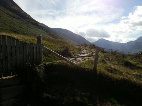
Yesterday I took a coach from Glasgow to Fort William, a little loch-side town in the Scottish Highlands at the base of Britain’s highest mountain, Ben Nevis. It was a three hour trip so to maximise my time there I took the first coach out of Glasgow at 7am, arriving at Fort William just after 10am.
Fluffing around the town centre looking for the tourist information centre started to make me feel a bit agitated because I was worried I wouldn’t be able to make it to the summit and back in time for the last coach back to Glasgow. Found it finally, after walking past it twice, got a map of how to get to the Glen Nevis Visitor Centre, got a map of the mountain track up the mountain, and as per the guide brochure to climbing the mountain I got a compass as well. I’m not actually sure I remember how to use a compass…
I left Fort William at 10.50am with my maps, compass, and Camelbak and an extra jacket and power walked to the Glen Nevis Visitor Centre 2km from the town. The guide said to allow 7 hours (4 hours up, 3 hours down) return trip so I really was getting flustered.
The track was impressive! In most places it was a thousand craggy steps of positioned rocks. It was a beautiful Scottish day, the sun was shining and hundreds of others were out attempting to climb Ben Nevis.

The last little bit of the hike was in the clouds and a fierce wind picked up. It was time to put my fleece layer back on and roll the leggings back down. I sweated up a storm until I reached the clouds and in the wind I cooled down pretty quickly. At this height, vegetation had stopped growing, and columns of rocks had been built to aid in track visibility for those who climb when there is still snow.
I was ever so slightly tempted to give up close to the summit. In the clouds I thought I’d be able to pass off any photo as being the top. But how could I come ALL this way and not successfully climb this mountain!? I’m so pleased I kept going because there was something to see.
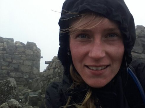
I’m not actually sure what this ruined building was, but I like to say to myself “In a land that played ‘Who’s the King of the Castle’ for centuries, I conquered Britain’s highest castle.”
Ben Nevis 1344m

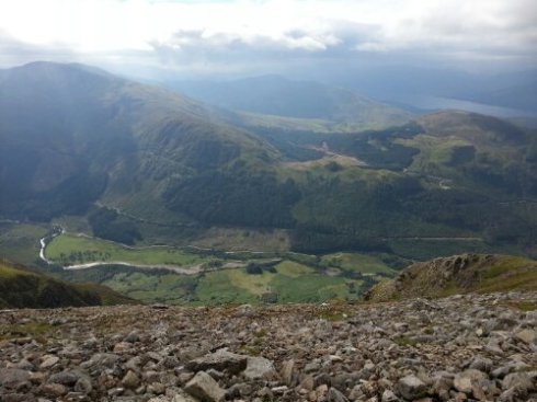
And I can say it’s the highest I’ve climbed becase not only is it the highest above sea level I have been, Fort William is only 20m above sea level, so I actually did climb over 1000m! 16km round trip from the base, plus 4km to and from Fort William. All in 5hours 10mins and with 45mins to spare until the next bus back to Glasgow.

I bought the ‘I climbed Ben Nevis’ tee shirt at the Visitor Centre. A real sense of achievement.
Until next time, thanks for reading!
5 Comments | tags: Ben Nevis, Britain, Fort William, Highlands, Mountain Climbing, Preparation for a Mountain Race, Scotland, Views | posted in Uncategorized
Just to keep in touch, I haven’t forgotten about the blog, I’m just on holiday in Europe.
Yesterday we (the coach tour group) went up Mt Pilatus in Switzerland by the cable car.
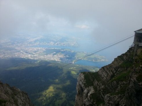
There is a walking track up the mountain and the information board said it would take 5hours to walk up to the summit at over 2000m.
If I had a chance I would definitely come back to have a crack at walking up.
It was very picturesque, think Heidi and her cows with bells, green pastures and wild flowers. Switzerland is without a doubt my favourite place so far and we are only 5 days in to the 16 day trip.

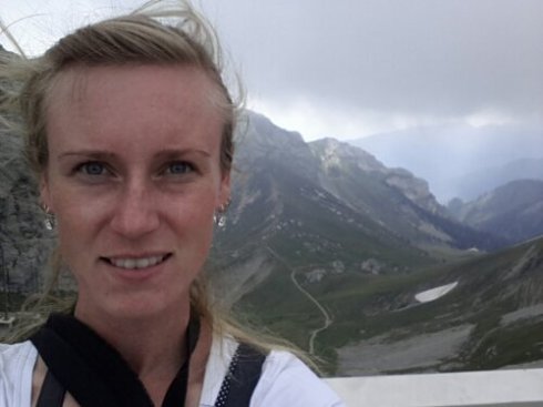
Off to Austria tomorrow.
Until next time, thanks for reading.
Leave a comment | tags: Amazing Views, Cable Car, Heidi, Mount Pilatus, Mountain, Pilatus, Switzerland, Walking Track | posted in Uncategorized
In an earlier post I wrote two goals that I wanted to achieve before I went on my holiday to Europe. Run 10k and climb the West Dome.
I conquered the Dome the second day of being at my parents house. Success!
Yesterday I just went out and ran 10km like I said I would. Success! And oh boy I’m feeling sore today.
The weather was quite conducive to running a good distance. It was still and the low cloud kept the temperature quite cool. It’s the same conditions today so no excuse for going not going for a massaging jog to release the muscles.

MapMyFitness stats – way over the 10km goal!

Run where “people” can see you, it will help you to keep going.
Leave a comment | tags: 10km, Achieving Goals, Fitness, In the Country, MapMyFitness, Mossburn, Mountain racing, Preparation for a moutnain race, Running, Success, Training | posted in Uncategorized

Panoramic of Northern Southland from the West Dome
Achieved goal #2. Climbed the West Dome!

Looking at the West Dome from the West end
I lived in Mossburn for 18 years and only attempted to climb it once when I was about 10 with a group of other kids on a Boys Brigade trip. We weren’t successful due to the weather and a couple of the other kids being just a bit too young to hack it.
This time, I used my father’s advice and drove along the forestry track right around to the West end of the mountain to climb up the Western ridge. Looking at it from the road, I couldn’t even imagine how I was going to get all the way up there! There was quite a bit of scrub to walk through to get to the ridge which seemed to take the most time. Once I got out of the scrub and onto the mountain, it was just straight on up from there. Literally. It felt like straight up.
It was very windy and the ridge was surprisingly narrow so I felt like I was going to get blown off the mountain and down its steep sides. For the most of the climb, I snuck along the North side to keep out of the wind and bypass rocky outcrops.

Looking over the Acton Valley towards Mid Dome and East Dome
It was an eery feeling being at the top. I’ve known this mountain for 25 years and she just looked completely different at the top. I have no idea what I was expecting. It was almost Lord of the Rings-esque.

MapMyFitness stats for this climb
The West Dome’s highest point is at 1256m (according to MapMyFitness), but starting from 600m it wasn’t too much of a climb, it was just a very intense climb over 5km. Considering half of the distance was a gentle ascent to get out of the scrub, really the actual climb was 600m over about 3km.

At the top – “how much did you pay for that hair do?”
One foot in front of the other climbs you a mountain.
Until next time, thanks for reading!
Leave a comment | tags: Fitness, Great Views, Hiking, MapMyFitness, Mossburn, Mountain racing, Northern Southland, Preparation for a moutnain race, Uphill, West Dome | posted in Uncategorized

I live in some stunning countryside!
That’s Leaning Rock and looking out towards the Alexandra Basin from Cairnmuir Hill.

Cairnmuir DoC track
Cairnmuir Hill is 12km along a DoC track from Cornish Point through to Clyde, a total distance of 25.5km according to the Walk Cromwell brochure.
I kicked my butt again today. Some pretty steady climbing was done along the way, not quite as intense as the Devils Creek track, it had more up and down parts to it which in its own way can tire the muscles out more. But climbing to 1121m over 12km, that’s just tiring anyway!

Today’s MapMyFitness stats
The things you see when you’re out walking (and hopefully one day running) the trails…

Boundary Hut – 8km

Where’s the rest of you? – merino rams horn
This up and coming week is my last one at work before I start my two month holiday. But before I go, I have a couple of goals I’d like to achieve. By putting them on this blog, I’m even more obligated to at least try to achieve them!
- Run 10km. I’m just going to go out and do it.
- Climb the West Dome. The mountain I grew up looking at and wearing as a symbol of Mossburn, but have never climbed. Hopefully there’s no more snow between now and then!
There. They’re in writing. I have to hold myself to it now!
Until next time, thanks for reading!
1 Comment | tags: Cairnmuir, Climb, Fitness, Goals, Great Views, Hiking, Hillclimbing, Local Walks, Mountain, Mountain racing, Preparation for a moutnain race, Trail running, Training, Uphill | posted in Uncategorized
Another beautiful day today. In fact, for the middle of winter, it was a little too warm! You can never please this southern Kiwi – we complain when its hot, dry, cold, wet and everything else in between. Hey, I think I even got a bit of sunburn!
I had a day off yesterday, the sun didn’t show itself until I was on my way home from work which makes getting through a day of work difficult enough. I received my weekly summary email from MapMyRide and I loved the first words I read: “Your greatness at a glance”.

Weekly summary email from MapMyRide screenshot
For a first week of any physical activity I’m feeling pretty happy with this report. Without a real training programme in place at the moment, and no coach, this app is really helping me out a lot. I said in my first post the biggest lesson I learned from my athletics days is I am responsible for my training. Without a weekly club and regional competitions to track my progress and make me accountable, all the information the app provides every time I go out will definitely help me to go further, longer, and harder as I have real numbers again to track.
I returned to the river track today after work and reran the route from Monday. The permafrost had melted and left quite a few slippery muddy patches. I still have a lingering cough which makes running through recovery feel like I’m having what I guess is an asthma attack after a tiny uphill climb. I don’t have asthma, but breathing when not 100% can get difficult. Anyhow, it was a good run, I was wearing far too many clothes and I got quite hot (as you do in the middle of winter!) and I ran the same 6km in a time 2mins faster than Monday. Success!!

Today’s MapMyRide stats

Kawarau River and Mt Difficulty – a mountain I plan to climb!
Until next time, thanks for reading!
Leave a comment | tags: After work exercise, Cromwell, Fitness, Kawarau River, mapmyride, Physical exercise, River track, Running, Sports, Trail running, Training | posted in Uncategorized
My old athletics coach said the best thing for sore muscles is to go for a gentle jog. Jogging is nature’s massage. Not that I’m overly sore from my mountain walk yesterday, but my muscles definitely took a hammering especially when I had to make my way down from the mountain in the freezing cold. It was a lovely day today and I was still feeling pumped over my achievement yesterday so straight after work I went for my very first run in a very long time.

Start of the river track

Out and about along the Kawarau River
I chose the river track along the Kawarau River, past more herring bone tailings. I like it because it’s quite sheltered amongst pine trees which will be good when summer arrives. Though it does mean in the winter the track is in a state of permafrost and it was quite slippery and muddy in places.

Permafrost track! Careful where you step.
It’s relatively level compared to a lot of terrain I have been walking on which made for a good first run outing – but there are some short and sharp drops/inclines which keep you from thinking it is too easy.
I’m a lot fitter than I thought! I managed to jog 6km in 40minutes.

MapMyRide stats for today
Feeling quite tired now. Time for a Chai tea and bed.
Until next time, thanks for reading!
2 Comments | tags: After work exercise, Cromwell, Fitness, Getting Started, Kawarau River, Local Walks, Mountain racing, River track, Running, Trail running, Training | posted in Uncategorized
I kicked my butt today!
I went back to the Devils Creek DoC track at Northburn and instead of just going up and back in an hour, I walked up and up and up, followed the track to see where it went. Up into the Dunstan Mountain Range
My only day off work this week threatened to crap itself and dump snow everywhere. When I got up this morning and saw sunshine, I powered through my housework, filled up my Camelbak hydration pack, and took off to the base. 3hrs to the Bendigo Conservation Area the sign said, I think I got there in just over an hour and a half, and kept going for another half an hour or so until I could not go on anymore.
It is the middle of winter here. The wind was screaming in from the south and about half way up I reached a snow line of sorts. The last half hour of the walk was in ankle deep snow and bitterly cold winds which I was not appropriately dressed for at all. I had to hide behind an outcrop of rocks just so I could maintain enough feeling in my fingers to take a picture!

At 1172m above sea level – bloody freezing!
I had MapMyRide going again in my pocket. A woman’s voice speaks out every kilometre, telling you how long you have been working out and split times for your k’s. At the beginning I was averaging 11minutes per km, at the top she said 14mins/km and then on the way down 9mins/km. Total distance 16.55km and a climb of 878m. Not a bad effort at all in 3hours and 15minutes.

MapMyRide stats for today’s walk
A good training outing I reckon, after reading the Northburn Station 50km stats, this track will be very useful. In fact, I think part of it is actually used in the race. Is it cheating?
Until next time, thanks for reading!
4 Comments | tags: Camelbak, Climb, Dunstan, Hiking, Mountain, Mountain racing, Northburn Station, Recreation, Snow line, Sports, Training | posted in Uncategorized
Central Otago is such a beautiful place. It has a rich gold mining history which has shaped the landscape and created a legacy which makes this place so unique. The mines, sluicings and abandoned settlements make great points of interest when out and about in this area, and the tracks to get to some of these places make great training opportunities. No excuses right?
Last night after work I made myself go for another quick walk – before I headed home and lost all motivation. I went to the Quartz Reef Historic Reserve for a look and to check out the track for future training possibilities.

Quartz Reef Historic Reserve
It was a nice and easy walk with a gentle climb nearer the end of the track.
I had heard about the herring bone tailings and it wasn’t until I saw the aerial photograph on the information board that I could appreciate what was being described.

The hearing bone tailings left by the gold miners 150years ago
This track I don’t think will become apart of my training programme. It wasn’t challenging enough and at only 2.4km round trip it wasn’t really long enough either. You don’t know these things until you try.
Until next time, thanks for reading!
Leave a comment | tags: Central Otago Gold Fields, Gold mining, mountain race, Otago, Preparation for a moutnain race, Trail running, Training | posted in Uncategorized


